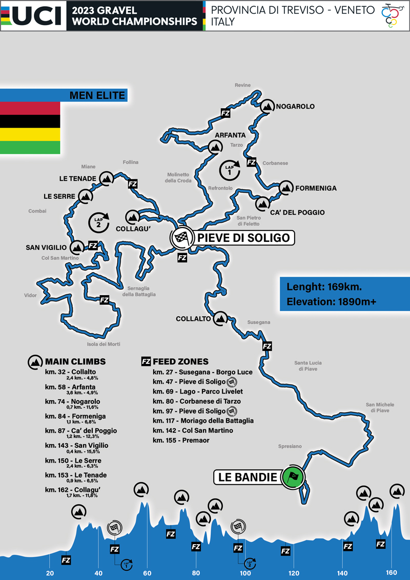
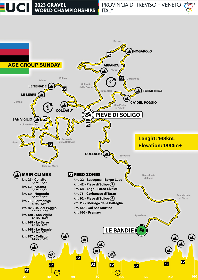
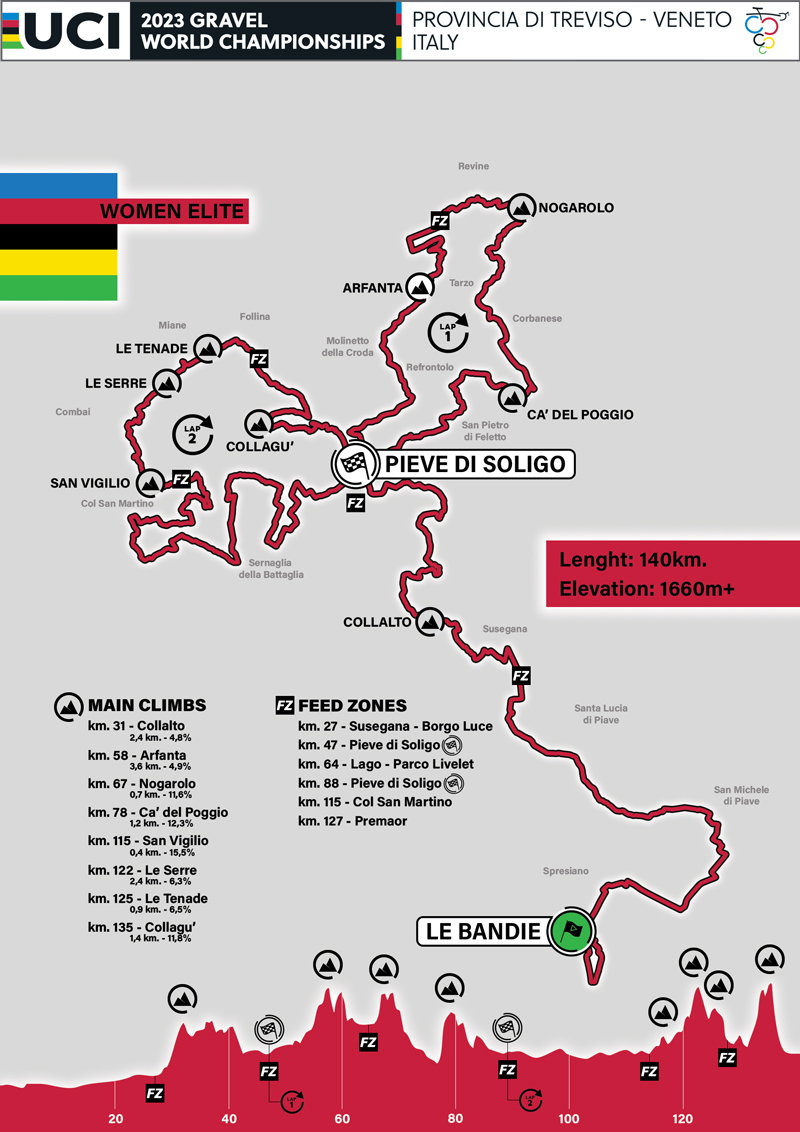
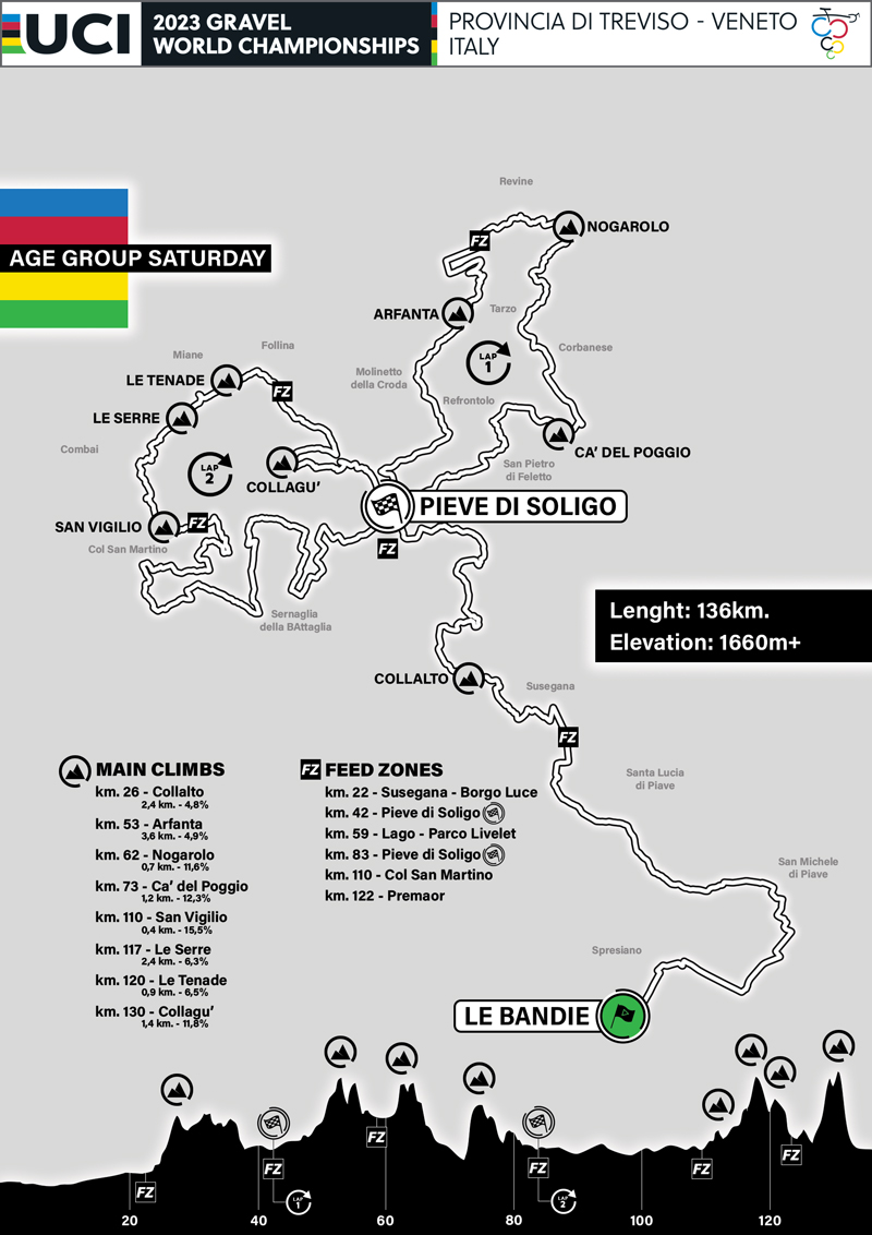
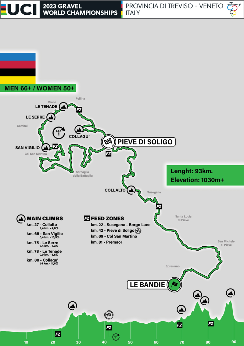
The start point is at the lake of Le Bandie di Spresiano, the location of the 2008 Cyclo-cross World Championships.
The land owned by the Mosole family has been transformed over the years from a quarry to a multipurpose sports centre that attracts off-road cycle enthusiasts, swimmers, canoeists, stalwart cross-country runners and many more sports lovers.
Following a circuit of the lake on the dirt road, we head towards Cimadolmo entering the Grave di Papadopoli and tackling the longest section of unmade road, 21 km, which skirts the river Piave. At Ponte della Priula we leave the riverbed and after crossing the Borgo Luce estate we negotiate the first slopes of the Collalto hills dominated by the splendid and iconic Castle of San Salvatore.
All around us the panorama is truly breathtaking: rows of leafy vineyards adorn the landscape along the slopes of the hills extending as far as the eye can see.
Magnificent white tracks lead us through this part of the Marca Trevigiana, full of castles, legends and vineyards until we reach Pieve di Soligo to cross the finish line for the first time. We now begin the first circular route heading towards Molinetto della Croda, one of the most picturesque corners of the Marca Trevigiana. Its typical example of 17th century rural architecture with the foundations resting on the bare rocks, the “croda” or crag of the mountain, has inspired artists and enthralled thousands of visitors.
On reaching Arfanta after a steep asphalt road, we negotiate the descent that takes us to Valsana dominated by Castelbrando, a fortress with a strong history and lots of charm located along the famous ‘Via del Prosecco’ wine road in the municipality of Cison di Valmarino, listed as one of Italy’s most beautiful villages The dirt roads of Valsana lead us firstly through the small town of Mure, a picturesque walled village with nativity scenes, ancient traditions and nature where time continues to be marked by the slow rhythms of the genuine local culture. We then reach the Revine Lakes.
We are at the foot of the Treviso Prealps and these two small lakes of glacial origin are what remains of a much larger lake formed by one of the branches of the Piave glacier during the various stages of the last ice age.
We climb towards Nogarolo, tackling the “wall” of the same name, a challenging warm up for the more famous (and harder) Cà del Poggio.
After tackling the trails of the Val Trippera (here too low gear ratios will be the order of the day) we pass beneath the finish tape to then take on the splendid first roads of the Patean, Palù di Sernaglia and Moriago. We proceed into the Island of the Dead, one of the most symbolic places in the Medio Piave area, recalling the great sacrifice of many young soldiers in the final days of the Great War.
From Colbertaldo without doubt the most challenging part of the course begins, tackling in order: the ascents of San Vigilio, Le Serre, Le Tenade and Collagù. We travel along both cement and dirt roads, immersed in the silence and solitude that culminates in the various ‘ciglioni’ (a type of vine-growing terrace) where the spectacle of nature is of incomparable beauty, striking the very heart and souls of cyclists.
The descent at San Gallo, with the characteristic ride over the cobblestones of the Church of the saints Peter and Paul, will be the last difficulty before reaching the final straight with arms raised at Pieve di Soligo with the finish line located in the elegant Piazza Balbi Valier.

